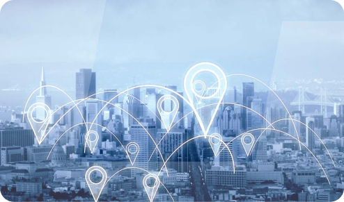
Geotab is a Fleet Management System based out of Canada. This system is currently a world leader in fleet management and is used by Companies and enterprises all over the world, including the US government, to effectively monitor and manage their entire Fleet. Geotab allows for this through the use of a telematic device which combines telecommunication and GPS. Together this system allows for a company to monitor driver and vehicle performance within the fleet.
Features

Active Tracking
- Real-Time Location Tracking
- Fast, precise location updates in MyGeotab
- Second by second trip and location data
- Monitor Drivers’ driving behaviour.
- Speeding
- Harsh acceleration or aggressive turning
- Seatbelt Usage
- The overall driving hours and breaks
- Any excessive idling time
- And the vehicle location.

Fleet Optimization
- Fuel savings.
- Manage idle time, speeding and mileage.
- Fuel card integration
- Preventative maintenance
- Remotely diagnose engine fault codes
- Categorize and suggest action.
- Monitor non-fault data such as low coolant and oil levels.
- Identification of underutilized assets
- Detect VIN on installation & tracks history.
- Record odometer and engine hour for each trip, automatically and accurately

MyGeotab
- Fleet Management on-the go
- Cloud-based
- Access My Geotab quickly and easily on your smartphone or tablet.
- Responsive design & Cross compatibility
- IOS, Android, Windows, Mac Linux
- Extensible Add-Ons through, Geotab Drive

Accident Detection Solution
- Automatic accident retrieval and reconstruction
- Data is used for court cases, Back-up detection via accelerometer and engine.

Datasets
- Dedicated forum
- Download reports freely.
- Powerful hierarchies and rollup
- Custom reports using MS Excel
- Dashboards based on Excel Graphics

Audible Alerts
- Unit can make an audible alert once it detects an exception breach. These exceptions can be customized. (e.g., Speeding, high RPM, Harsh Braking, Excessive idling etc.)
- This alter will prompt drivers to immediately respond to the alerts by a change in their driving behaviour.

Security
- Systems built from the ground up to be secure.
- Secure live updates
- Signed firmware PKI.
- All communication encrypted AES 256
- Big Data intrusion detection
- Two-factor authentication (2fa)
- All data drives encrypted.
- Secure OS
- Regular Security scans
- Staff training & war room

Safety
- Posted road speed vs actual.
- Seat belt use with occupation detection
- After-hours vehicles use alerts.
- Risk and safety reports, with driver ratings and safety trending reports
- In-vehicle driver coaching – Audible Alerts
- Unit can make an audible alert once it detects an exception breach. This exception can be customized. (e.g., Speeding, high RPM, harsh Braking, excessive idling, etc.)
- This alert will prompt drivers to immediately respond to the alerts by a change in their driving behaviour.

Productivity
- Provides analytical information and reports to allow for proper reporting and decision making.
- Import or sync customers via the SDK.
- On-road time vs customer time
- Routing – Planned vs actual
- Data analytics
- Infinite flexibility in the rule creation & custom reports

Capabilities
Geotab Capabilities in regard to IVMS:
- Tracking the current location of the vehicle online (on screen) 24 hours / 7 days a week through satellite location
- Whenever the ignition is on – storing IVMS data every second
- Receiving and applying geofence information.
- Risk and safety reports, with driver ratings and safety trending reports
- The geofences can be categorized to any user-defined category, including – but not limited to no-go zones and environmentally sensitive areas.
- GPS location through satellite
- Date and time data
- Retaining a minimum of 500 min

Benefits
- Reduce motor vehicle accidents.
- Reduces speeding.
- Encourages safety belt use.
- Improves at-risk driver behaviour.
- Improve Road Safety Performance
- Reduce Cost through fuel management, route optimization, and hours of service.
- Analytical reporting
- Diagnostic reports and feedback
- 24/7 vehicles/ equipment location
- Geofences and alerts
- Ability to set groups within the system.

